
PLANNING VISUALS
Planning visuals help communicate proposed developments clearly and accurately to planning authorities, committees and the public.
They provide visual evidence that supports planning submissions, showing how a project will appear within its real‑world context. From verified views to CGI photomontage and aerial imagery, planning visuals ensure transparency, accuracy and professionalism throughout the planning process.
What Are Planning Visuals
They combine technical precision with visual clarity, enabling planning teams and decision‑makers to interpret the impact of a proposal.
Planning visuals include verified views, CGI photomontage, aerial CGI photomontage, and contextual site imagery. They are used for planning submissions, Design and Access Statements, committee reviews, and public engagement sessions.
Planning visuals connect technical documentation with tangible spatial understanding, making complex schemes straightforward to communicate.
Why They Matter
Planning visuals are essential for clear communication and informed decision making.
They help planning officers and committees evaluate how a development fits into its surroundings, ensuring transparency and compliance with local guidelines.
Key reasons they matter: provide visual clarity for non‑technical audiences, demonstrate scale, massing and materials accurately, support environmental and heritage assessments, reduce misinterpretation of design intent, improve approval chances through professional presentation.
Accurate planning CGI builds trust and credibility, showing that the proposal has been carefully considered within its context.
Verified Views
Verified Views are the most precise method of presenting planning CGI, produced through measured survey data, photography, and 3D modelling.
They demonstrate exactly how a proposal will appear from defined viewpoints, meeting the verification standards required by planning authorities.
Verified Views include:
- surveyed camera coordinates
- lens and elevation data
- geometrically aligned 3D models
- calibrated lighting and perspective
- supporting methodology documentation
They are typically required when:
- the site lies within a visually sensitive area
- the proposal may influence protected or heritage views
- committees request formally validated visual evidence
Verified Views give planners assurance that every image meets technical and procedural expectations.
Aerial Photomontage
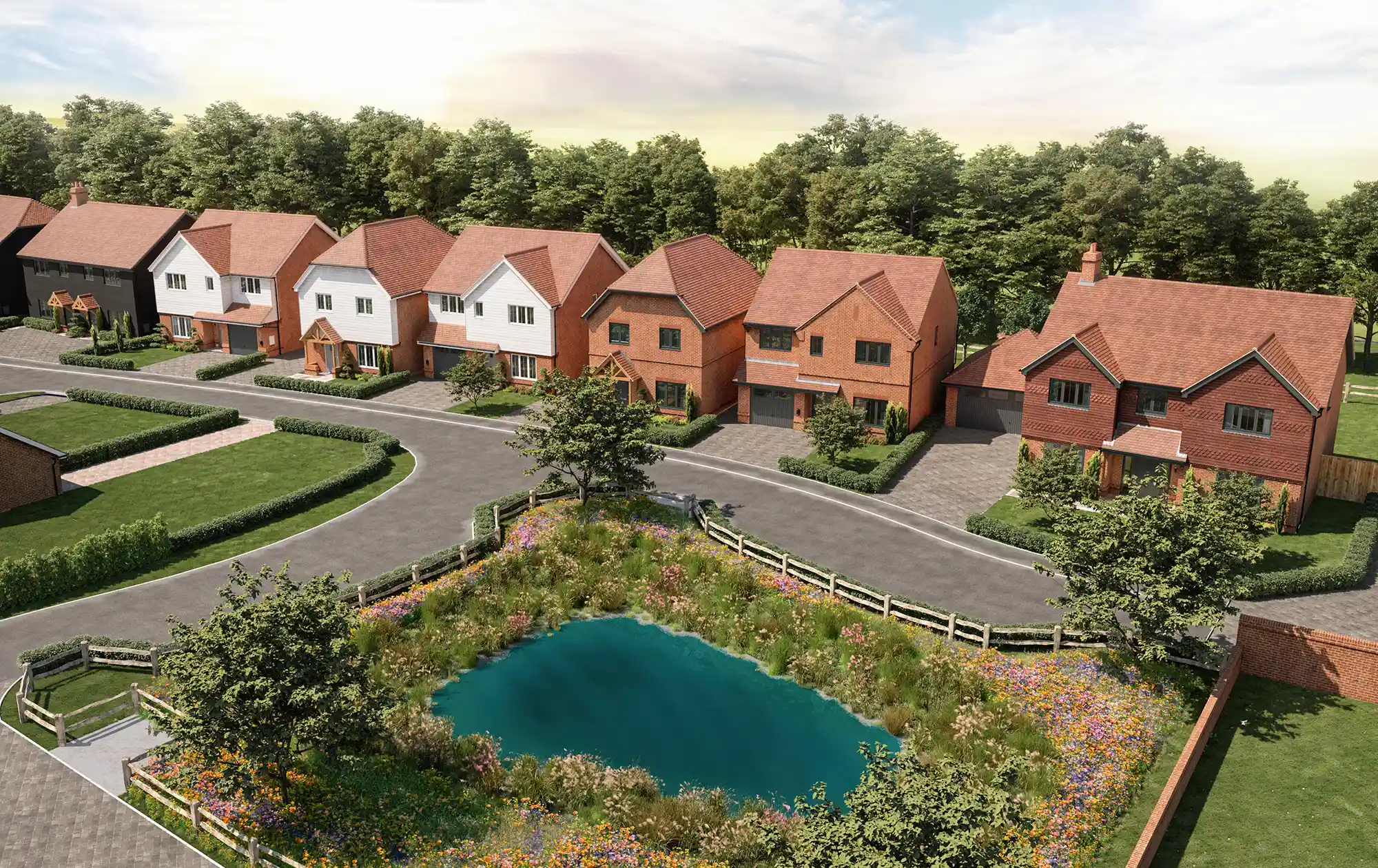
Aerial CGI Photomontage offers a broader contextual perspective, illustrating how a scheme integrates with its surroundings when viewed from above.
It is particularly valuable for extensive or multi‑building developments where layout, circulation, and landscape relationships must be clearly understood.
Aerial Photomontage helps demonstrate:
- site configuration and massing
- access routes and movement patterns
- landscape and environmental design
- adjacency to neighbouring structures
- wider ecological or visual impact
Common applications include:
- residential masterplans
- commercial or mixed‑use estates
- regeneration and infrastructure projects
- early‑stage feasibility studies
Aerial Photomontage provides planners with a complete understanding of spatial context, supporting both consultation and formal submission stages.
Photomontage
CGI photomontage combines 3D modelling with real photography, creating realistic visuals that show how a development integrates with its surroundings.
It is widely used for planning submissions, public consultations and marketing presentations.
Photomontage helps illustrate:
- contextual integration
- material choices
- façade treatments
- impact on neighbouring properties
It is ideal for:
- residential developments
- commercial buildings
- refurbishments and extensions
- urban design proposals
CGI photomontage provides a clear, accessible visual reference, helping planners and communities understand the proposal accurately.
Planning Requirements
Planning requirements differ between local authorities, yet CGI consistently plays a crucial role in meeting visual, contextual, and technical expectations.
Typical requirements include:
- precise representation of scale and massing
- integration of proposals within their surroundings
- verified viewpoints for visually sensitive areas
- photomontage demonstrating streetscape impact
- methodology documentation supporting verified views
Planning visuals contribute to:
- Design & Access Statements
- committee and stakeholder presentations
- public consultation materials
- heritage and conservation assessments
Professional planning imagery ensures submissions are persuasive, compliant, and visually clear, helping streamline reviews and accelerate approval decisions.
RELATED TOPICS
See how Visual Trick created refined interior CGI for Wells Rd, presenting the internal layout, material palette, and spatial atmosphere of this Bristol residence with clarity and precision.
Explore the Gas Works project to see how planning CGI supports residential developments with clarity and accuracy.
interior and exterior CGI in The Green residential refurbishment project.
See how Visual Trick applied exterior and planning CGI techniques in the Windmill Road residential development.
architectural design and exterior CGI in the Healthcare Headquarter project.
Exterior CGI, Planning CGI, and Property CGI to support the Horsham Care Home development.
Read about Horley Care Home development.
Learn about East Grinstead Care Home.
FAQ
Ready to Elevate Your Project?
Planning visuals help you communicate your proposal with precision, clarity and professionalism.
If you require verified views, photomontage or aerial CGI for planning applications or committee reviews, our team can deliver dependable, high‑quality imagery that strengthens your submission.
