
3D visualisation is the process of generating photorealistic, spatially accurate digital models that represent proposed developments in their real-world context. In planning public inquiries, these models are the most effective tool for translating complex technical proposals into something every stakeholder can understand and respond to. The role of 3D visuals in planning public inquiries extends well beyond aesthetics. They shape the quality of public debate, the accuracy of submissions, and ultimately the decisions inspectors make. Architectural visualisation, the recognised industry term for this discipline, has moved from a marketing aid to a core instrument of planning transparency.
How do 3D visuals improve comprehension in public inquiries?
3D visuals provide clear spatial context that reveals geometry, scale, and the relationship between a proposed development and its surroundings. That spatial clarity is the single biggest gap in traditional 2D plans. A planning inspector or a local resident looking at a site layout drawing cannot intuitively judge how a six-storey building will sit against an existing terrace. A photorealistic 3D model answers that question immediately.
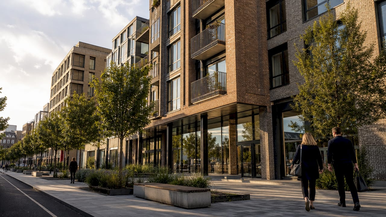
The impact on stakeholder feedback is significant. When community members can see a proposal at eye level, they give specific, grounded responses rather than vague objections based on misreading a plan. 3D consultation visuals help residents understand visual impacts such as wind turbines in rural landscapes by providing close-up and distant views alongside comparisons with existing structures. That specificity produces more useful submissions for the inquiry record.
3D visuals also close the language gap between technical teams and non-technical participants. An engineer’s section drawing communicates accurately to another engineer. A photorealistic render of the same structure communicates to everyone in the room. The shift from technical notation to realistic imagery removes a significant barrier to meaningful participation.
Key comprehension benefits include:
- Scale and massing: Stakeholders judge height, bulk, and proximity far more accurately from a 3D model than from a plan.
- Landscape integration: Models built on LiDAR terrain data and aerial photography show how a development sits within its actual topography.
- Shadow and daylight: Accurate sun-path modelling reveals overshadowing effects that 2D drawings cannot show.
- Streetscape impact: Eye-level views place the viewer on the pavement, giving an honest impression of the pedestrian experience.
Pro Tip: Ask your visualisation studio to produce both a drone view and a pedestrian-level view for every key viewpoint. Inspectors and community members read space differently from different heights.
What technologies power effective 3D visualisation for planning?
The most capable planning visualisation tools today use game-engine technology to build interactive, immersive models. ENGAGE3D, developed by LUC, uses this approach to allow users to move through a development site interactively, comparing proposed scenarios against real landscapes using datasets including LiDAR and aerial imagery. Game engines process geometry and lighting in real time, which means a planner can walk through a model during a hearing rather than flicking between static slides.
The data inputs that underpin accuracy are equally important. A credible planning model draws on:
- LiDAR terrain data to reproduce ground levels and topography with survey accuracy.
- Aerial photography to texture existing buildings and land cover realistically.
- Ordnance Survey mapping to position the development correctly within its street and landscape context.
- Architect’s BIM or CAD files to represent the proposed scheme at the correct geometry and scale.
- Photographic site surveys to capture materials, colours, and existing built form.
Combining these sources produces a model that can withstand scrutiny at a public inquiry. A model built on incomplete or inaccurate data will be challenged, and rightly so.
The table below summarises the key differences between traditional 2D representations and modern 3D visualisation in a planning context.
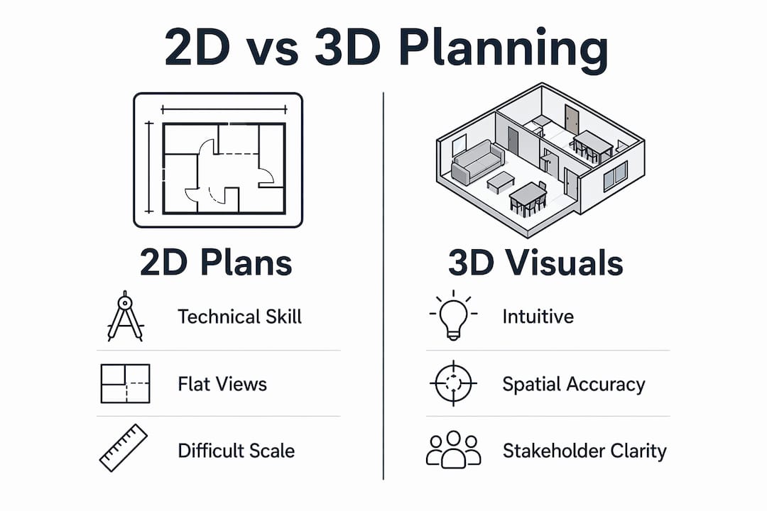
| Feature | 2D plans and sections | 3D visualisation |
|---|---|---|
| Spatial comprehension | Requires technical literacy | Accessible to all stakeholders |
| Scale judgement | Difficult without experience | Immediate and intuitive |
| Landscape integration | Abstract | Photorealistic and contextual |
| Scenario comparison | Static, separate drawings | Interactive, side-by-side |
| Iterative updating | Time-consuming reprints | Rapid model amendments |
3D architectural visualisations accelerate design processes and reduce errors by allowing designers to test proposals digitally before they reach the inquiry stage. That error-reduction benefit carries directly into the inquiry room, where a model that contradicts the written evidence is a serious credibility problem.
Pro Tip: Specify that your 3D model must be updatable throughout the inquiry process. Proposals change during hearings, and a static model produced six months earlier may no longer represent the current scheme.
How should planners incorporate 3D visuals into the inquiry process?
Digital engagement tools, including interactive maps and visual content, improve public consultation participation and make complex planning information more accessible. The UK Government’s own guidance on digital community engagement confirms that combining digital visuals with traditional methods produces clearer communication and stronger community trust. That combination is the right model for public inquiries.
Practical integration requires planning from the outset, not as an afterthought. The following approach reflects best practice for planners and public officials:
- Commission visuals early. Brief your visualisation studio at the same time as your technical consultants. Visuals produced late in the process often reflect an earlier scheme version.
- Align viewpoints with the Environmental Impact Assessment. Agreed viewpoints from the EIA process should be reproduced in the 3D model so that the visual evidence is consistent across all documents.
- Use visuals in pre-inquiry meetings. Presenting a 3D model at a pre-inquiry meeting gives all parties the opportunity to raise accuracy concerns before the hearing begins.
- Provide public access before the hearing. Publishing an interactive model online before the inquiry opens allows community members to engage at their own pace and submit more considered representations.
- Update the model as the scheme evolves. Interactive digital models updated iteratively throughout the planning process allow stakeholders to see how proposals change and respond with informed feedback. That ongoing visual dialogue strengthens transparency.
- Pair visuals with plain-language explanation. A photorealistic render without context can mislead. Always accompany visuals with a written description of what the viewer is looking at and what has been assumed.
Accurate 3D visualisations reduce uncertainty by allowing validation of designs through realistic spatial models, which helps prevent costly errors. At an inquiry, that validation function is as important as the communication function. A model that has been tested against survey data gives the applicant’s team a defensible evidential base.
The CGI for planning applications process works best when the visualisation brief is written alongside the planning statement, so that the visual evidence directly supports the written case.
What are the challenges and future prospects of 3D visuals in inquiries?
3D visualisation is not without limitations, and planners should approach it with clear eyes. High upfront costs, potential over-reliance on visuals, and the necessity of accurate data inputs are the three most significant barriers to effective implementation. Each requires a deliberate response.
Cost is the most frequently cited obstacle. A high-quality interactive model built on survey-grade data is a substantial investment. For smaller applications, the cost may outweigh the benefit. The right question is not whether 3D visuals are affordable in principle, but whether the complexity and controversy of the specific proposal justifies the expenditure.
Over-reliance on visuals is a subtler risk. A compelling render can create an impression of certainty that the underlying data does not support. Inspectors are alert to this. Visuals must be accompanied by a clear methodology statement that explains the data sources, the assumptions made, and the limitations of the model.
“The credibility of a 3D model at a public inquiry depends entirely on the quality of the data behind it. A photorealistic image built on inaccurate inputs is not evidence. It is an illustration.”
Emerging technologies are expanding what is possible. Integration with Geographic Information Systems (GIS) allows planning models to draw on live spatial datasets, keeping the model current as surrounding conditions change. Artificial intelligence is beginning to automate the generation of baseline models from existing survey data, reducing production time and cost. Immersive technologies, including virtual reality headsets, are being piloted in consultation settings to give participants a fully embodied experience of a proposed development.
The trajectory is clear. 3D visualisation benefits will become more accessible as production costs fall and data infrastructure improves. Planners who build 3D visual evidence into their standard inquiry toolkit now will be better placed as these tools become the expected norm.
Key takeaways
3D visualisation is the most effective method for communicating complex planning proposals to non-technical stakeholders in a public inquiry setting, and its credibility depends on accurate data, early commissioning, and iterative updating throughout the process.
| Point | Details |
|---|---|
| Spatial clarity drives better feedback | 3D models help stakeholders judge scale and impact, producing more specific and useful inquiry submissions. |
| Data quality determines credibility | Models built on LiDAR, aerial photography, and survey data withstand scrutiny; those built on assumptions do not. |
| Early commissioning is non-negotiable | Visuals briefed at the start of the project align with the scheme and the EIA, not a superseded version. |
| Iterative updating strengthens transparency | Updating the model as the scheme evolves shows good faith and keeps the visual evidence current. |
| Pairing visuals with explanation prevents misreading | Every render needs a written methodology statement to be treated as evidence rather than illustration. |
Why 3D visuals changed how I think about public inquiries
I have watched planning inquiries where the applicant’s team spent three days trying to explain a scheme that a single well-built 3D model would have communicated in three minutes. The frustration in those hearings is real, and it falls hardest on community representatives who are trying to engage in good faith but cannot read a technical drawing.
The shift I have observed over the past several years is not just technological. It is cultural. Planners who use 3D visual evidence well are not just producing better exhibits. They are signalling that they take public participation seriously. That signal matters to inspectors, and it matters to communities.
The pitfall I see most often is commissioning visuals too late. A model produced after the inquiry programme is set cannot be updated to reflect scheme changes without disrupting the hearing timetable. The teams that get this right treat the visualisation brief as a live document from the day the application is submitted.
My advice to any planner preparing for a contested public inquiry is straightforward. Invest in the data before you invest in the imagery. A photorealistic render built on inaccurate terrain data will be taken apart in cross-examination. A technically rigorous model, even a relatively simple one, will hold up. The visual quality matters less than the evidential quality behind it.
— Paride
Visualtrick’s planning visuals for public inquiries
Planning inquiries demand visual evidence that is accurate, credible, and clear to every person in the room.

Visualtrick produces planning visuals built specifically for this purpose, from photorealistic CGI renders to interactive 3D models that hold up under cross-examination. Every image is grounded in survey-accurate data and aligned with the written planning case. Whether you need agreed viewpoint renders for an EIA, 3D rendering services for a complex urban scheme, or CGI that communicates a proposal to a non-technical audience, Visualtrick delivers visuals that strengthen your inquiry presentation from the first pre-inquiry meeting to the final hearing day.
FAQ
What is the role of 3D visuals in planning public inquiries?
3D visuals translate complex planning proposals into spatially accurate, photorealistic representations that all stakeholders can understand. They improve the quality of public submissions, support inspector decision-making, and demonstrate transparency throughout the inquiry process.
How do 3D models differ from traditional 2D planning drawings?
3D models show scale, massing, and landscape integration in a way that requires no technical literacy to read. Traditional 2D plans communicate accurately between professionals but create significant comprehension barriers for community members and non-specialist decision-makers.
What data sources make a 3D planning model credible?
Credible planning models draw on LiDAR terrain data, aerial photography, Ordnance Survey mapping, and the architect’s BIM or CAD files. Models built on these survey-grade inputs can withstand scrutiny at a public inquiry; those built on assumptions cannot.
When should 3D visuals be commissioned for a public inquiry?
Visuals should be commissioned at the same time as the technical consultants, not after the inquiry programme is set. Early commissioning allows the model to align with the EIA viewpoints, reflect the current scheme, and be updated iteratively as the proposal evolves.
Can 3D visuals be used during the inquiry hearing itself?
Interactive 3D models built on game-engine technology, such as those using the ENGAGE3D approach, allow planners to navigate through a development site in real time during a hearing. That interactivity lets the presenting team respond to questions by showing specific views on demand rather than relying on pre-selected static images.
