
Any development that falls inside a designated viewing corridor or exceeds a threshold plane under the London View Management Framework (LVMF) must be supported by a verified visual assessment before the application is determined. The LVMF is Supplementary Planning Guidance (SPG) to the London Plan, and the GLA confirms that development exceeding threshold planes is likely to harm viewers’ ability to recognise and appreciate strategically important landmarks. That is a planning refusal risk, not a technicality.
First steps when your site may be affected:
- Check the GLA’s MP1–MP27 Management Plan PDFs and the data.gov.uk LVMF spatial datasets to confirm whether the site intersects a designated Viewing Place or Protected Vista.
- Check proposed building heights against the relevant threshold plane, expressed in metres above Ordnance Datum (OD).
- Appoint a survey and visualisation lead early — ideally before massing is fixed.
- Identify the relevant Management Plan number (MP1–MP27) and pull the Visual Management Guidance for that view.
Pro Tip: Start view analysis at pre-application stage. Discovering a threshold breach after massing is fixed costs far more in abortive design work than commissioning a verified view model at the outset.
Key takeaways
The London View Management Framework requires verified visual evidence for any development that intersects a designated viewing corridor or exceeds a threshold plane, and non-compliance is a direct ground for refusal.
| Point | Details |
|---|---|
| Check the spatial data first | Use the GLA’s MP1–MP27 PDFs and data.gov.uk datasets to confirm whether your site falls within a designated view corridor before fixing massing. |
| Use the Erratum for calculations | The 2012 LVMF SPG contains a known error on page 282; always use the GLA Erratum document for threshold plane calculations. |
| VVMs must be survey-controlled | Simple renders are routinely rejected; camera positions must be established by GNSS or precise levelling, tied to OSGB36 and Ordnance Datum. |
| Check local policies too | Where St Paul’s Heights or another local regime applies alongside the LVMF, the lower height threshold takes precedence. |
| Visualtrick for planning-grade visuals | Visualtrick delivers survey-controlled VVMs, wirelines, and methodology statements built to LVMF evidential standards for planning submissions. |
Table of Contents
- What does the London View Management Framework actually protect?
- What are the statutory policy foundations of the LVMF?
- How does the LVMF define and measure views?
- When is an LVMF assessment required and what must you submit?
- What design responses does the Visual Management Guidance require?
- How do you commission verified views and planning-grade CGI for LVMF submissions?
- Where do you find the official LVMF documents and spatial data?
- What are the planning risks if you get the LVMF assessment wrong?
- A practitioner’s perspective on LVMF submissions
- Planning-grade verified views for LVMF submissions
- Sources
What does the London View Management Framework actually protect?
The LVMF designates approximately 27 views across London, grouped into four categories: London Panoramas, River Prospects, Townscape Views (which include Linear Views), and Protected Vistas. Each category carries different assessment logic, but all share the same underlying objective: preserving viewers’ ability to read and appreciate the city’s most significant landmarks.
Protected Vistas are the most tightly controlled. Three landmarks are classed as Strategically Important under the SPG:
- St Paul’s Cathedral
- The Palace of Westminster
- The Tower of London
Each Protected Vista contains two spatial components. The Landmark Viewing Corridor is the triangular area drawn between an assessment point and the landmark itself. The Wider Setting Consultation Area envelopes that corridor and captures development that, while outside the direct sight line, could still affect the perceived setting of the landmark. Development inside the Wider Setting Consultation Area does not automatically breach the LVMF, but it triggers consultation and requires careful assessment of visual impact on the landmark’s backdrop and silhouette.
London Panoramas — views from elevated points such as Parliament Hill or Primrose Hill — protect broad sweeping views of the city’s skyline. River Prospects protect views along and across the Thames, where the relationship between water, bridges, and landmark buildings is particularly legible. Townscape Views and Linear Views protect more contained urban vistas, often along historic streets or from specific civic spaces.
The March 2012 LVMF SPG contains a Management Plan for each of the 27 designated views, with Visual Management Guidance addressing foreground, middle ground, and background assessment for every one of them.
What are the statutory policy foundations of the LVMF?
The LVMF sits within a layered policy structure. Understanding which instrument does what matters when you are writing a planning statement or responding to officer queries.
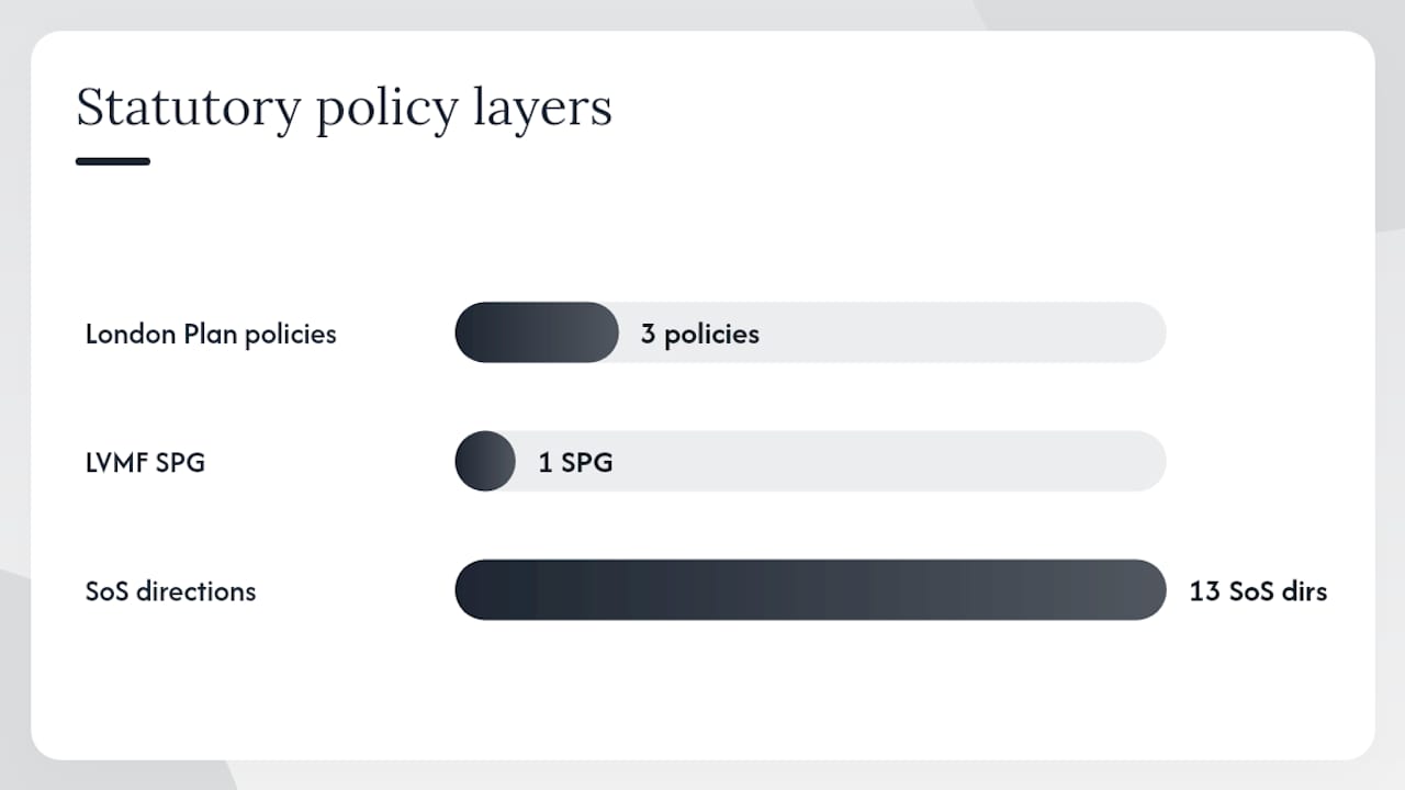
London Plan Policy 7.10 protects the character and composition of strategic views and requires that development within or affecting them is assessed against the LVMF SPG. It applies to all designated view types.
London Plan Policy 7.11 deals specifically with London View Management and requires that development does not harm the ability of viewers to recognise and appreciate Strategically Important Landmarks. This is the policy most directly engaged when a proposal sits inside a Protected Vista.
London Plan Policy 7.12 addresses Strategically Important Landmarks themselves, requiring that their setting, silhouette, and composition are protected and, where possible, enhanced.
The LVMF SPG gives operational detail to all three policies. As SPG, it is a material consideration in planning decisions — not a development plan document — but boroughs are required to take it into account in their Development Plan Documents, and planning officers treat non-compliance as a substantive ground for refusal.
Borough-level policies add a further layer. The City of London’s St Paul’s Heights policy is the most prominent example: the City of London Protected Views SPD explains that where both the St Paul’s Heights regime and the LVMF apply to the same site, the lower height threshold takes precedence. Teams working in the Square Mile must check both frameworks and design to the stricter constraint.
The principal actors in the process are:
- The Mayor of London / GLA — owns the LVMF SPG and is a statutory consultee for applications that exceed threshold planes or affect Protected Vistas.
- The borough planning authority — determines most applications and must apply both the LVMF and any local view protection policies.
- The Secretary of State — has issued directions for 13 of the Protected Vistas, adding a further layer of statutory protection beyond the SPG.
How does the LVMF define and measure views?
Precision matters here. Planning officers and inspectors will check your drawings against the SPG geometry, so the terminology needs to be exact.
Assessment Point and Viewing Place. Each designated view has one or more defined Assessment Points — specific locations from which the view is measured. The Viewing Place is the broader area around the Assessment Point within which the public experiences the view. Submitted drawings must reference the Assessment Point by its OSGB36 National Grid coordinates and, for camera positions in verified views, include full camera metadata (position, height above OD, focal length, sensor size).
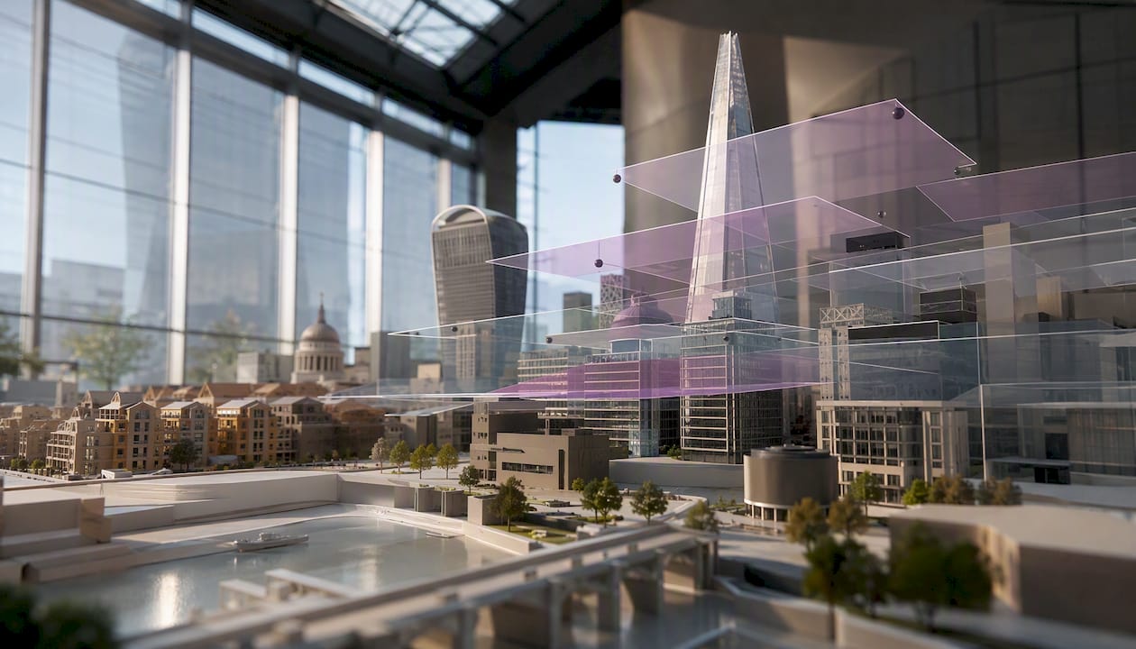
Threshold planes. A threshold plane is a defined height surface, expressed in metres above Ordnance Datum, above which development within a Protected Vista’s Landmark Viewing Corridor would intrude into the protected sight line. The Landmark Viewing Corridor is derived geometrically from the sight line between the Assessment Point and the landmark. Any part of a proposed building that penetrates the threshold plane triggers the consultation and assessment requirements of the SPG.
Note on the Erratum. The published 2012 SPG contains a known technical error on page 282 relating to the calculation procedure for maximum permitted development within a Protected Vista’s foreground. Use the GLA Erratum document when carrying out threshold calculations — do not rely on the uncorrected SPG text.
The three parts of a view. The SPG structures assessment around foreground, middle ground, and background:
| View part | Typical distance | Assessment focus |
|---|---|---|
| Foreground | Immediately around the Assessment Point | Massing, street-level enclosure, and framing of the view |
| Middle ground | Between foreground and landmark | Building heights, gaps between structures, and silhouette legibility |
| Background | Behind the landmark | Sky exposure, backdrop quality, and avoidance of cluttered skylines |
Each part carries different Visual Management Guidance. A building that sits in the foreground of a panorama is assessed differently from one that appears in the background of a Protected Vista, even if both technically fall within the same designated view boundary.
Submitted drawings should label all heights in metres above OD, include National Grid coordinates for every key point, and reference the relevant Management Plan number. Where threshold plane diagrams are reproduced from the SPG, they should be scaled accurately and annotated to show the proposed building envelope in relation to the plane.
When is an LVMF assessment required and what must you submit?
Triggers for assessment
An LVMF assessment is required when any of the following apply:
- The site lies within a strategic view corridor identified in the LVMF SPG.
- The proposed development exceeds, or could exceed, a threshold plane within a Protected Vista’s Landmark Viewing Corridor.
- The proposal affects the setting, silhouette, or composition of a Strategically Important Landmark (St Paul’s Cathedral, Palace of Westminster, Tower of London).
- The site falls within a World Heritage Site buffer zone or setting where views to or from the WHS are material.
- The borough’s local plan or pre-application advice identifies the site as falling within a local view protection zone (e.g. St Paul’s Heights in the City of London).
Camden Council’s guidance confirms that applications within strategic view corridors must include scale drawings, elevations above Ordnance Datum, and Verified Visual Montages as supporting evidence — and that simple renderings are insufficient.
Submission checklist
- Scale drawings and elevations with all heights expressed in metres above Ordnance Datum.
- Verified Visual Montages (VVMs) from each relevant Assessment Point, produced to planning-grade standards.
- Annotated wirelines and wireframe overlays showing the proposed building envelope against the threshold plane.
- A signed methodology statement covering survey control, GNSS or levelling methodology, camera metadata, and model validation.
- Viewpoint coordinates in OSGB36 National Grid format, with camera height above OD.
- Management Plan references: cite the relevant MP number(s) and reproduce or reference the applicable Visual Management Guidance.
- Where the Mayor referral threshold is met, allow additional time for GLA review — typically several weeks beyond the standard determination period.
For paper submissions, check the borough’s requirements for the number of hard copies. For Planning Portal uploads, confirm file size limits and preferred formats (PDF for drawings; TIFF or high-resolution JPEG for VVMs).
Pro Tip: Prepare a short cover note that maps each submitted document to the relevant SPG requirement and Management Plan section. Planning officers dealing with multiple applications will reach a decision faster when the evidence is clearly cross-referenced.
What design responses does the Visual Management Guidance require?
The LVMF’s objective is not to prevent tall buildings — it is to ensure new development preserves viewers’ ability to recognise and appreciate strategic landmarks. Design integration, not height alone, is what the SPG tests.
Design principles drawn from the Visual Management Guidance:
- Avoid crowding landmark silhouettes. A cluster of buildings of similar height immediately behind St Paul’s drum and dome, for instance, reduces the legibility of the landmark’s profile against the sky.
- Protect gaps between buildings in panoramas. These gaps allow the eye to read individual landmarks and prevent the skyline from becoming a continuous wall.
- Avoid canyon effects in River Prospects. Buildings that line both banks at similar heights compress the view and reduce the sense of openness that characterises protected Thames views.
- Manage foreground massing carefully. Even a building that does not breach a threshold plane can harm a view if its bulk in the foreground overwhelms the framing of the landmark.
- Protect the sky backdrop behind landmarks. A clean sky exposure behind the dome of St Paul’s, for example, is a specific attribute identified in the relevant Management Plans.
Massing, roof profile, and material choices all affect how a building reads within a view. A slender tower with a tapered top and a light-coloured or reflective upper section will generally perform better in a background assessment than a flat-topped block of equivalent floor area. Stepping upper storeys back from the street edge reduces apparent bulk in the foreground. Alignment matters too: a building oriented to minimise its apparent width from the Assessment Point will have a smaller visual footprint than one presenting its broadest face to the sight line.
Early-stage tactics worth building into the design process:
- Set back upper storeys above the threshold plane height to reduce sky intrusion.
- Use slender tower forms rather than wide slabs where the site is within a Landmark Viewing Corridor.
- Test multiple massing options against the threshold plane before committing to a scheme.
- Use contrast in material or colour to preserve silhouette legibility of the landmark behind the proposed building.
Pro Tip: Run iterative VVM snapshots at multiple distances and times of day during design development — not just at the statutory Assessment Points. A scheme that passes the formal test can still create a poor visual relationship with a landmark when seen from an informal viewpoint nearby, and planning officers notice.
How do you commission verified views and planning-grade CGI for LVMF submissions?
Verified Visual Montages are not standard architectural renders. Planning officers routinely reject photomontages that lack survey control, camera metadata, or model validation — and a rejected VVM means a delayed or refused application. Understanding what to specify in a brief is as important as finding a capable studio.
Methodology requirements for planning-grade VVMs
- Survey control: camera positions must be established by GNSS survey or precise levelling, tied to OSGB36 National Grid and Ordnance Datum. A hand-held GPS reading is not sufficient.
- Camera metadata: lens focal length, sensor dimensions, and camera height above OD must be recorded and reproduced in the submitted methodology statement.
- 3D model validation: the model used to generate the VVM must be validated against the survey data and the threshold plane geometry from the relevant Management Plan.
- Authenticated survey points: where the SPG specifies a fixed Assessment Point, the camera must be positioned at that exact coordinate, not approximated.
Visualtrick’s guide on how 3D models become planning images covers the technical workflow from survey data to submitted planning image in detail.
Deliverables to specify in a brief
- VVMs from all required Assessment Points, at the correct focal length specified in the Management Plan.
- Annotated wirelines and wireframe overlays, with the threshold plane shown as a labelled horizontal datum.
- Elevation overlays showing the proposed building height in metres above OD against the threshold plane.
- Short animated walkthroughs or sequential stills where the view involves movement (e.g. a River Prospect seen from a moving vessel or a Linear View along a street).
- A signed methodology statement suitable for inclusion in the planning report.
File formats matter. Planning officers typically require high-resolution PDFs for report inclusion and uncompressed TIFFs or high-resolution JPEGs for the VVM plates themselves. Confirm the borough’s requirements before finalising deliverables.
The planning visualisation guidance published by Visualtrick explains how each type of visual serves a different evidential purpose in a planning submission — useful background for teams briefing a studio for the first time.
Where do you find the official LVMF documents and spatial data?
Every LVMF assessment must cite primary sources. The following are the documents and datasets teams should consult and reference:
- LVMF SPG (March 2012): available from the GLA’s London View Management page, in two parts. Part 1 covers policy context and assessment methodology; Part 2 contains the Management Plans.
- MP1–MP27 high-resolution PDFs: downloadable from the Mayor’s LVMF high-resolution files page. These are the working documents for each designated view and must be cited by MP number in every assessment.
- Protected Vistas appendix and LVMF Erratum: both available from the same GLA page. The Erratum corrects the calculation error on page 282 of the SPG and must be used for threshold calculations.
- LVMF spatial datasets and heights data: published on data.gov.uk. These GIS layers allow teams to check whether a site falls within a viewing corridor and to derive threshold plane heights programmatically.
- City of London St Paul’s Heights guidance: the City of London Protected Views SPD is essential for any site in or near the Square Mile and sets out how local height constraints interact with the LVMF.
- City of London mapping services: WMS and WFS endpoints from the City of London’s mapping portal can be integrated with GIS and modelling tools for verified view production and threshold analysis.
What are the planning risks if you get the LVMF assessment wrong?
Non-compliance with the LVMF is a substantive ground for refusal, not a procedural one. Planning authorities treat compliance with the SPG’s Visual Management Guidance as a near-binary test: either the development preserves the viewer’s ability to recognise and appreciate the landmark, or it does not.
Common outcomes when LVMF issues are not resolved before submission:
- Pre-application redesign request from the borough or GLA, adding weeks or months to the programme.
- Mayor referral where threshold planes are exceeded or a Protected Vista is affected — the Mayor can direct refusal or require design amendments as a condition of consent.
- Refusal where the Visual Management Guidance is not respected and the applicant cannot demonstrate a positive contribution to the view.
- Conditional approval requiring design amendments, further verified views, or a Design Code commitment before implementation.
Mitigation actions that reduce these risks:
- Carry out a desktop view check at the earliest design stage, before any massing is presented to the client.
- Request pre-application advice from the borough and, where a Protected Vista is involved, from the GLA as well.
- Commission stage-gated VVMs at concept, scheme design, and detailed design stages so that each iteration is tested against the threshold plane before the next stage begins.
- Prepare alternative massing options and include them in the pre-application submission to demonstrate that the design team has tested the constraints.
- Where the proposal does breach a threshold plane, prepare a positive contribution statement showing how the design improves the view’s legibility, composition, or setting.
The procedural timeline for a site within a Protected Vista should allow for: pre-application engagement (four to eight weeks), verified modelling (two to four weeks per iteration), GLA referral window (typically eight weeks), and potential requests for additional information. Starting view analysis late compresses all of these stages simultaneously.
A practitioner’s perspective on LVMF submissions
The most consistent mistake teams make with LVMF submissions is treating the verified view as a document to be produced at the end of the design process, rather than a design tool used throughout it.
A few practical points from studio experience:
- Align survey control before anything else. Disputes about camera position or OD height at the validation stage are expensive. Fix the survey methodology with the planning officer at pre-app.
- Keep VVMs legible. A cluttered montage with too many annotations obscures the very thing the officer needs to see: the relationship between the proposed building and the landmark. One clear image with a clean threshold plane overlay is worth more than six busy composite plates.
- Annotate for recognition tests. Label the landmark clearly on every plate. Officers assessing whether a viewer can “recognise and appreciate” a landmark need to see the landmark identified, not hunt for it.
- Communicate early with the planning officer. A brief conversation at pre-app about which Assessment Points the officer considers most critical can save a full round of additional VVMs after submission.
- Present visuals in the report, not just as appendices. Embed the key VVM plates within the planning statement or design and access statement, with explanatory text alongside each image. Officers reading a report should not have to cross-reference a separate appendix to understand what they are looking at.
An early VVM produced during concept design once revealed that a proposed building’s roofline would sit directly behind the lantern of St Paul’s when seen from a key Assessment Point. The massing was adjusted before the scheme was presented to the client, avoiding a redesign at planning stage. That is the value of treating verified views as a design input rather than a submission formality.
Planning-grade verified views for LVMF submissions
Visualtrick produces planning-grade architectural visualisations built to the evidential standards the LVMF and borough planning authorities require: survey-controlled VVMs, annotated wirelines, threshold plane overlays, and signed methodology statements ready for inclusion in planning reports.

The practical benefit is straightforward. A well-produced VVM set reduces the likelihood of an officer requesting additional information, shortens the referral process, and gives the design team a clear record of how each iteration performs against the threshold plane. For architects and developers working on sites within Protected Vistas or London Panoramas, that clarity at each design stage is what keeps programmes on track. Visualtrick works with developers, architects, and planning consultants across the UK on projects where visual evidence is a planning requirement, not an afterthought. To discuss your project’s LVMF requirements or request a quote, contact Visualtrick via the CGI for architects service page.
Sources
- London View Management Framework | London City Hall
- London view management framework assessments in planning applications – Camden Council
- Protected Views SPD – City of London
- London View Management Framework high-resolution files
- Dataset – data.gov.uk
